Software Solutions for Emission Modelling
Being fully integrated in QGIS, LimAQ allows you to benefit from the mannifold mapping options in the QGIS environment, including webmapping in 2D and 3D.
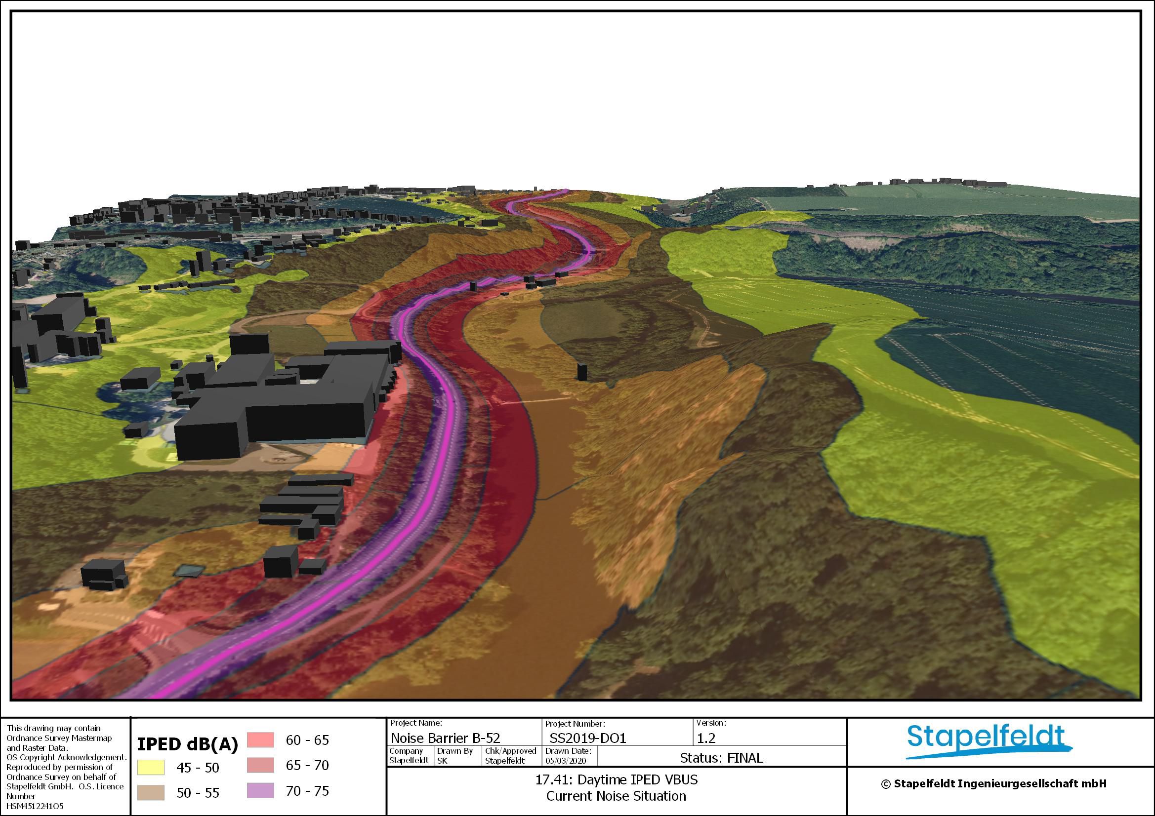
The QGIS layout manager provides a complete and intuitive framework to create professional looking, highly customizable print and digital maps. Just choose a webmap service like Google, Bing or OSM as your background map and present the results of your computations in an appealing and understandable way for your target audience. You can export your maps as pdf, image or vector file and you can also save your signature corporate map design to make your maps stand out from the crowd.

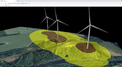
On top of 2D maps, you can also visualize computation results in 3D and create digital and print maps with its content.
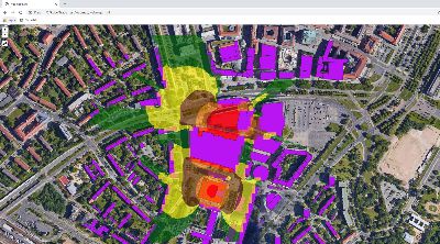
When it comes to making policy decisions, stakeholder participation is more often than not - a necessity. While laying out paper plans in the mayors office still works, you might as well offer your clients to take a step into the 21st century and offer them to create a webmap where they can have a look at the planned construction zones and their computed exposure - from wherever they want and whenever they want!
The Qgis2threejs plugin allows for adding noise calculation results to a 3D webmap is eqaully simple and can help to visualize construction plans and their noise potential. The map can easily be embedded in your webpage or used for presentation purposes.