Software Solutions for Emission Modelling
LimA™ Software is the complete solution for all environmental noise projects. The software is used by acoustic consultants, environmental authorities, heavy industries and educational institutes. The modular program package provides the best solution for whichever project you have, from small-scale industrial situations to large-scale city noise mapping. LimA™ uses state-of-the-art calculation cores with huge capacity and high calculation speed so that you get results quickly while reducing your investment in computing power. Depending on the task, you can use the tool that suits you and the task best for efficient, powerful environmental noise prediction and analysis. Furthermore the LimA™ system provides the tools to fully integrate environmental noise predictions in other Geographical Information Systems like ArcGIS or QGIS. Noise predictions for industry, roads, railways, aircraft and wind turbines are all supported.
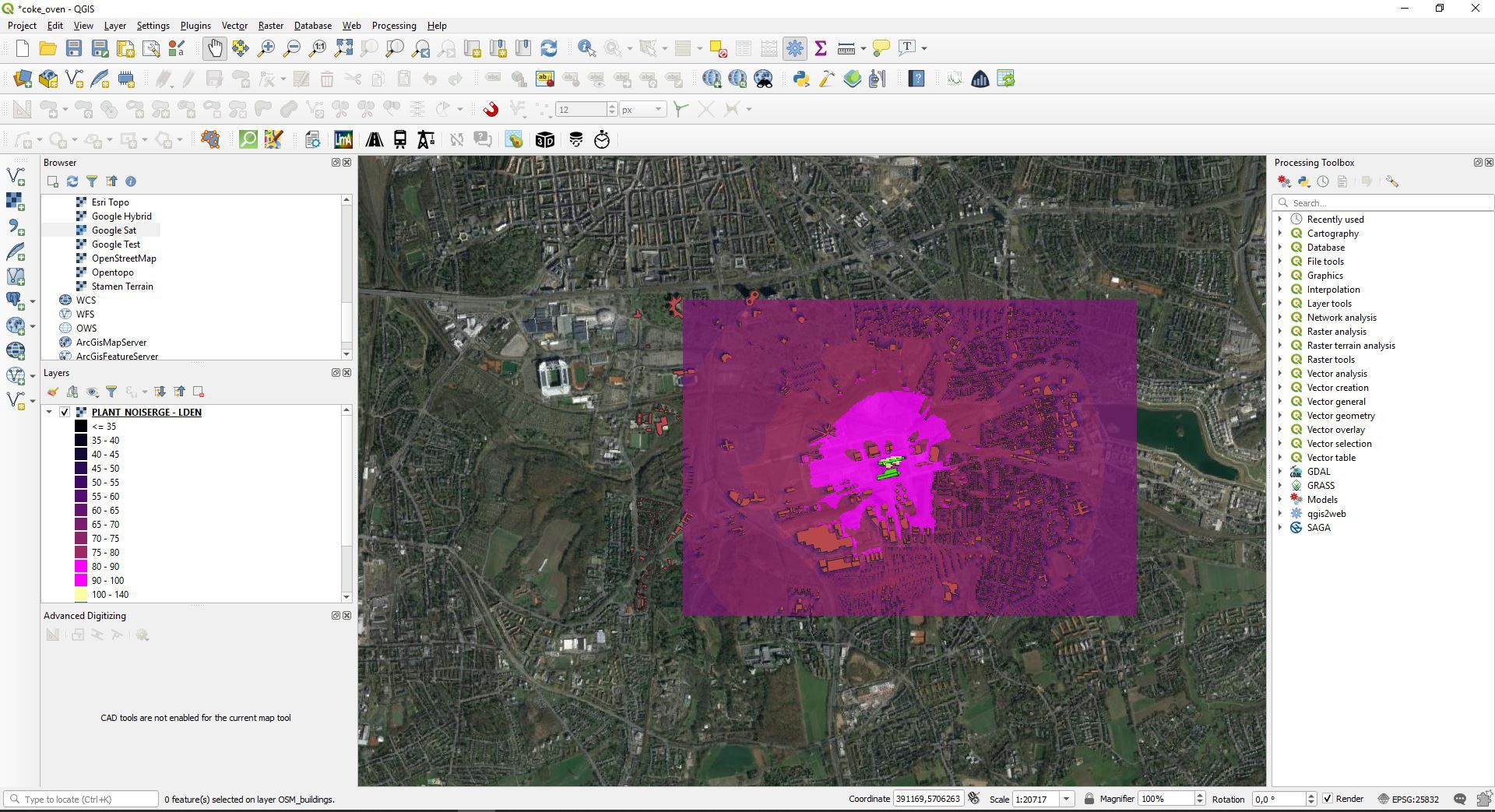
LimA can now be integrated in Quantum GIS with the LimAQ plugin. Users benefit from the renowned QGIS interface and its mannifold geo-processing abilities. Being an open-source tool with a long tradition in the geo-community, there are endless computation possibilities and customizations available. Wether you want to publish noise maps online or extract height information from DSMs to OSM building footprints - it is all out at your hands.
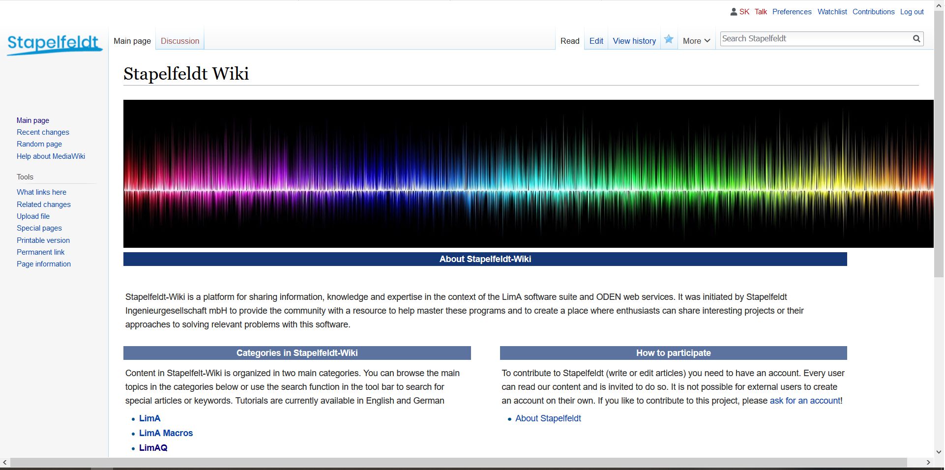
Our in-house Stapelfeldt Wiki enables you to quickly take-up the skills to perform road-, industry-, rail- or any other noise calculation in LimA, LimAQ and ODEN. It is based on our input and on a strong user community. The Wiki is based on MediaWiki, which is best known for its implementation on Wikipedia.
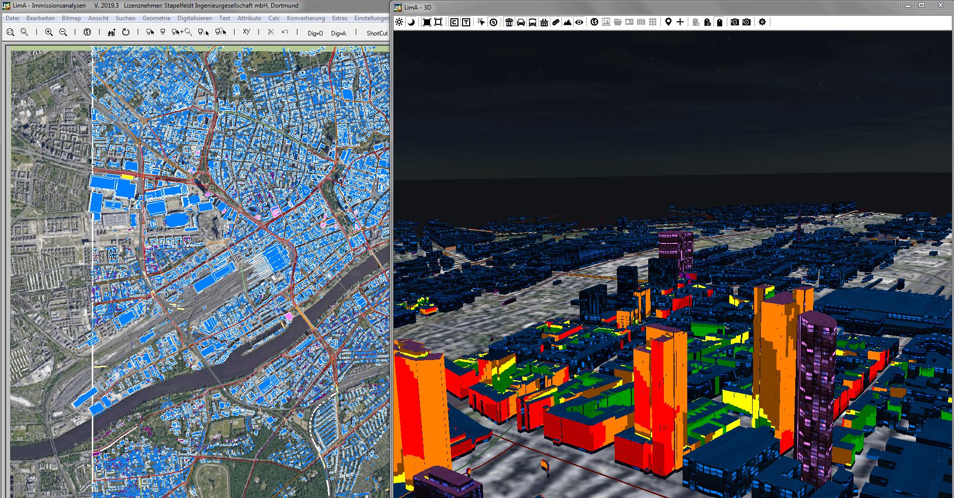
LimA offers two main options to display your noise or pollution maps in a convenient and appealing way. Maps can either be draped over WMS maps like Google and OSM or they can be viewed in 3D with the built-in 3D viewer. In the 3D viewer the user can choose from different building facades and background maps. The illumination can be set according to the task.
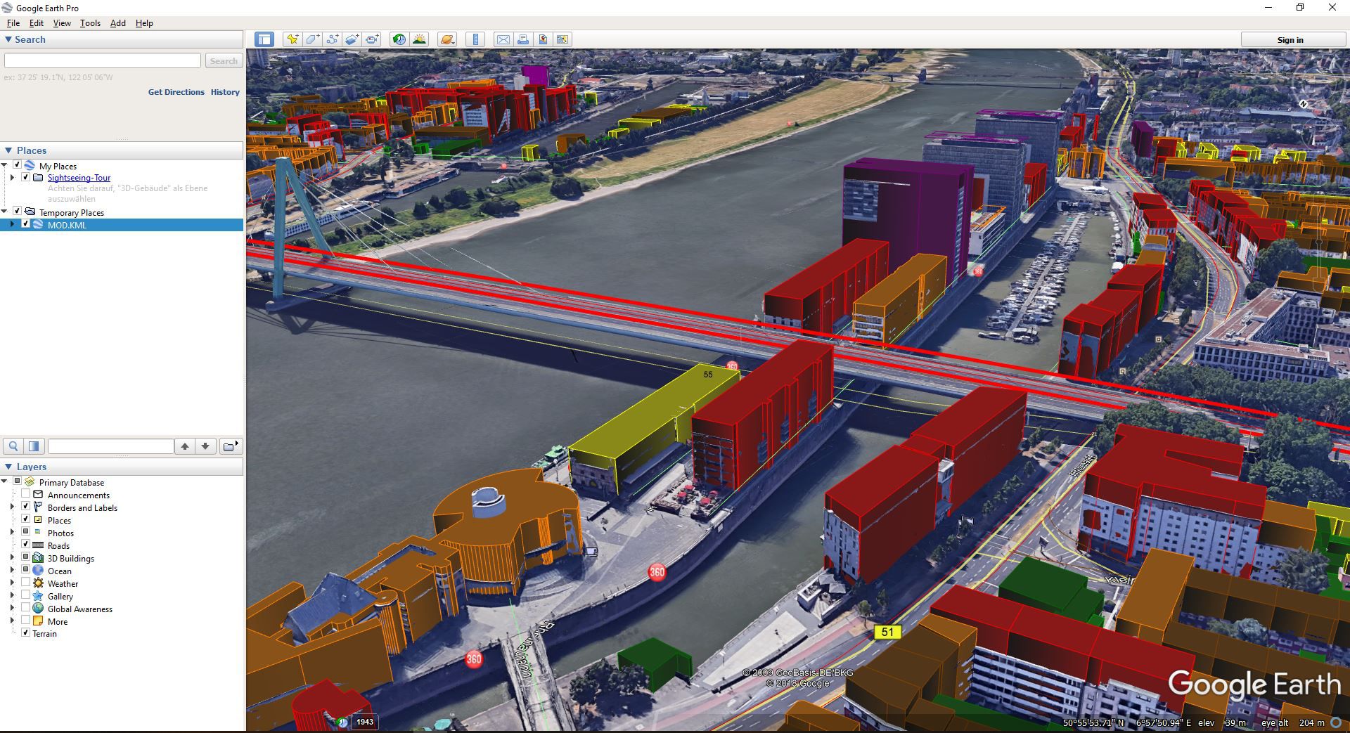
LimA can handle complex geometries with ease. Clear indexation of vertical relationships provides for lean models and fast calculations. Models can be exported to KML for easy use in third party tools like GoogleEarth.
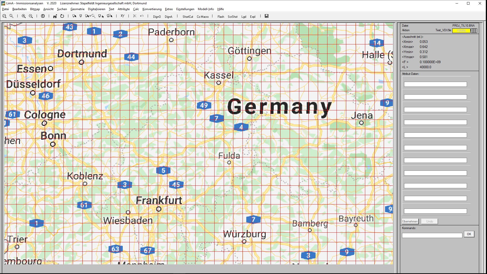
While Lima 64-bit generally has a model limit of 437,000 emittors and 2,187,500 obstacles, LimA can handle even larger models with virtually no size limit with the in-built tiling functions. This way, calculations for whole cities and even countries have been executed.
CNOSSOS, Harmonoise, ISO 9613, CRTN, DAL 32, RMR – SRM2, NMPB – 2008, XPS 31 – 133, BS 5228, MSZ 15036, RLS 90 (including draft 2016), DIN 18005, RVS 3.02, UT2.1 – 302, VDI 2714 – 2720 – 2571, OAL 28, SCHALL 03 (1990 and 2014), AKUSTIK 04, TRANSRAPID, OAL 20, CRN, MSZ 2904, VBUS, VBUSch, VBUF and VBUI.